Mississippi River Flood of 2011

At least as to river heights, the Flood of 2011 may be second or third largest Mississippi River Flood in modern times. Total volume of the flood is hard to compare because the river and the tributaries are more constrained than in the past. Water in a leveed river will be much higher than in a river without levees where it can spread out horizontally.

Projected flood heights – NOAA – Corps’ Morganza floodway projections

Satellite images of the floods

Historical flood levels


Flood Risk from Opening the Morganza Floodway

Estimated Inundation Spring 2011 Flood Date: 06 May 2011 – Version 1, 06 May 2011 (EGIS Map ID No. 11-051-009)

Floodway into the Atchafalaya Basin saves New Orleans: Oliver Houck

“The Mississippi River is rising, the Army Corps of Engineers has just blown a controversial floodway levee north of Cairo, Ill., and the surge is coming downstream.

New Orleans will be safe, however, not because of its high river levees, which could be challenged if 2 million cubic feet per second swirl by at 8 miles an hour, chewing on the banks, even with a few feet of freeboard. Rather, the city is safe because of another floodway to the west, the Atchafalaya, that can take half the Mississippi’s highest flows and funnel them safely to the Gulf.

We also are safe because we have the rights to use this floodway, free and clear. This was not always the case. In fact, it became the case only after a long fight that ran for nearly 20 years over the Atchafalaya basin…

Read the rest of this editorial by Professor Oliver Houck of the Tulane Law School.

Mississippi Rising – The View from Baton Rouge

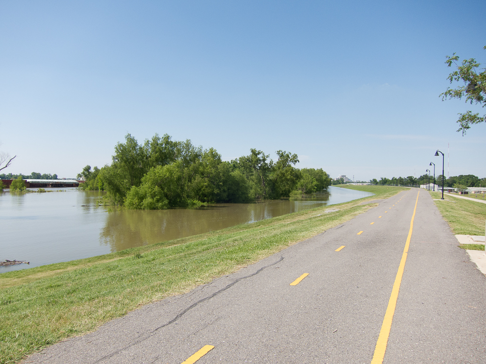
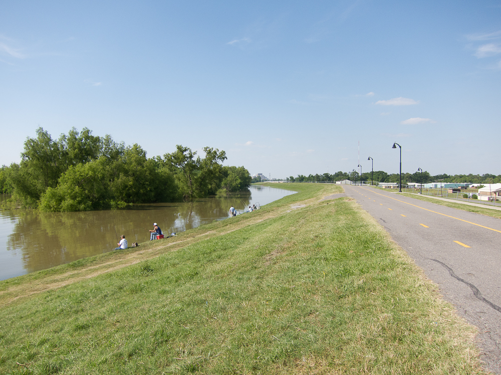
These pictures were taken on the levee at the intersection River Road and Stadium Drive in Baton Rouge. The normal river channel is out near the barges. Flood stage (where the river would top the banks if there was no levee) is 35 feet.

6 May 2011 – River stage 37.7 feet

5 May 2011 – River Stage 37 Feet

Climate Change and the National Flood Insurance Program – 1991

FEMA, Projected Impact of Relative Sea Level Rise on the National Flood Insurance Program, October 1991.

This study of the impact of relative sea level rise on the National Flood Insurance Program was authorized by Congress and signed into law on November 3, 1989. The requirements of this study as specified by the legislation are as follows:

SEC. 5. Sea Level Rise Study

The Director of the Federal Emergency Management Agency shall conduct a study to determine the impact of relative sea level rise on the flood insurance rate maps. This study shall also project the economic losses associated with estimated sea level rise and aggregate such data for the United States as a whole and by region1. The Director shall report the results of this study to the Congress not later than one year after the date of enactment of this Act. Funds for such study shall be made available from amounts appropriated under section 1376(c) of the National Flood Insurance Act of 1968.

The Control of Nature – Morganza Spillway

John McPhee has written a fascinating history of the River Control Structure at Morganza. While it is not clear that the Mississippi still wants to go down the Atchafalaya, losing the River Control Structure in a flood would still be a catastrophe that could rival Katrina.

“Three hundred miles up the Mississippi River from its mouth—many parishes above New Orleans and well north of Baton Rouge—a navigation lock in the Mississippi’s right bank allows ships to drop out of the river. In evident defiance of nature, they descend as much as thirty-three feet, then go off to the west or south. This, to say the least, bespeaks a rare relationship between a river and adjacent terrain—any river, anywhere, let alone the third-ranking river on earth.”

Read more http://www.newyorker.com/archive/1987/02/23/1987_02_23_039_TNY_CARDS_000347146#ixzz1LLXpMSem

Blowing the Mississippi Levee – 2011

Missouri’s TRO against the Corps to prevent the blowing of the levee on the Mississippi in May 2011: complaintanswer; and district court opinion (upheld by the circuit court – Missouri v. U.S. Army Corps of Engineers, 11-01937, U.S. Court of Appeals for the Eighth Circuit (St. Louis)., and review was denined by the Supreme Court.)

This same issue was litigated when the Corps modified the levee system at this point, and Missouri tried to block the work based on failing to consider earthquakes under the EIS:

Story v. Marsh, 732 F.2d 1375 (8th Cir. 1984) – More levee law

Joint Statement From Agriculture Secretary Tom Vilsack And FEMA Administrator Craig Fugate On The Opening Of The Birds Point-New Madrid Floodway In Central Missouri

Interesting that almost none of the media pays attention to the legal situation of folks in the Missouri floodway – they originally got the land with easements on it, or sold an easement to the feds later. The original purchasers got the land very cheaply, precisely because of the easements. With time, everyone forgets that every day they are on land is a gift, not an entitlement. Then when the floodway is used, congress comes in and bails them out as if they owned the land free and clear.

The worse problem is playing out over the decision to open the Morganza spillway in Louisiana. This has not been opened since 1973, and it is full of people who forgot that is a spillway. This then inhibits the corps in opening the spillway, which then increases the belief that it will never be opened. The Corps should be opening Morganza right now, rather than seeing how much stress the downstream levees can take. For example, the major prison in LA, Angola, is on a bend in the river. The projected crest is now higher than the levee at Angola, and the state is starting the process of evacuating a max security prison with more than 5,000 prisoners. That would not be necessary if Morganza was open. Baton Rouge is facing a crest 4 feet about the previous record, which may put some water over the levee on the Port Allen (west side) of the river, since those levees are a little lower. While 47.5 feet is below the level of the levees, it is enough to drive a lot of water under the levee. You can already see the water level in the drainage ditches near the levee going up, and sand boils are carrying water several thousand feet from the river into neighborhoods. If things are not as the Corps thinks they are with the levees, and a boil blows out like in Cairo, you could get a lot of flooding fast. The conventional wisdom in LA is that Mississippi river levees do not break, but that is only true until it isn’t. (They are built and maintained better than hurricane levees, but the Corps knows a lot less about the geology in south LA than it thinks.)

So, should we let people live and farm in spillways at all? My vote would be to make them wilderness, and to open them pretty regularly to keep the charged with silt and filled with wetlands.

This post will be updated as more information is available.
ASCE – The New Orleans Hurricane Protection System: What Went Wrong and Why

“On the morning of August 29, 2005, Hurricane Katrina struck southeast Louisiana and triggered what would become one of the worst disasters ever to befall an American city. The devastation was so extensive, and the residual risk looms so ominous, that, more than a year later, the future of New Orleans remains clouded. The members of the ASCE Hurricane Katrina External Review Panel have conducted an in-depth review of the comprehensive work of the United States Army Corps of Engineers (USACE) Interagency Performance Evaluation Taskforce (IPET) to better understand this tragedy and prevent similar disasters from happening again. The report, The New Orleans Hurricane Protection Systems: What Went Wrong and Why, focuses on the direct physical causes and contributing factors to the hurricane protection system failures. It was developed not to repeat the IPET information, but to interpret the broader significance of the findings. Written for both technical and general audiences, the report gleans valuable information related to the science and technology of hurricane flood protection as well as an overview of what caused the disaster. A fascinating read, “The New Orleans Hurricane Protection Systems: What Went Wrong and Why” offers hope for not just the future of New Orleans, but for all other hurricane and flood-prone areas of the country.”

ASCE, The New Orleans Hurricane Protection System: What Went Wrong and Why (A Report by ASCE Hurricane Katrina External Review Panel) Reston, VA: ASCE (2007) – Original link

Against the Deluge: Storm Surge Barriers to Protect New York City

Original link

Monday, March 30th, 2009 – Part I. THE THREAT OF COASTAL FLOODING

First Half – Session Chair: Michael Lorczak, P.E., AECOM, New York, NY (ASCE Met Section President)

Second Half – Session Chair: Mike Bobker, Co-Chair, Environmental Sciences Steering Committee, NYAS

Tuesday, March 31st – Part II. ENGINEERING THE STORM SURGE BARRIERS

First Half – Session Chair: Dr. Rae Zimmerman, Professor, NYU-Wagner Graduate School, New York, NY

Second Half – Session Chair: Dr. Douglas Hill, P.E., Consulting Engineer, Huntington, NY


The Worst Case in Disaster Planning

http://www.nola.com/opinions/index.ssf/2011/04/we_have_to_imagine.html

Good points in the editorial. I also think that we should look at the worst cases. However, politicians, and the disaster planners who work for them, usually do not want to admit that their plans do not cover the worst cases because that would require very unpopular actions. Two examples come to mind.

In smallpox policy, we do not want to talk about mandatory immunizations or even universal immunizations because the vaccine is risky. But the worst case models show smallpox introduced at multiple points (as would be likely in a bioterrorist act) infecting and killing millions before it is controlled with incremental immunization strategies. (For more info on smallpox.)

On the Louisiana coast, the worst case is New Orleans utterly flattened by Cat 5 winds (most housing destroyed and most trees down, likely on the housing) and then completely flooded. That reality would require serious reconsideration of current rebuilding and levee projects, and would further undermine the real estate market. That makes it politically impossible to consider. Before Katrina, it had become politically impossible to admit New Orleans could flood, which was the primary reason for the late evacuation call and the opening of shelters in the city. A few more years without a bad storm and the politicians will again convince themselves that the city has been protected by the levees.

Mississippi Flood History

The Mississippi Delta has always been defined by the sediment flow of the river and level of the ocean. Of these two, sediment flow is less important than ocean level – ocean level has varied more than 200 feet over geologic time. With the ocean level rising, the sediment level does affect how fast the delta is inundated. With a full sediment load and no levees, ocean rise would not submerge the delta as quickly. (It is important to remember that the delta was already receding before man started building levees and dams.) But the Mississippi has been leveed along most of its length, limiting both the sediment going into the river and the ability of the river to deposit this sediment over the delta during floods. Dams have also been built on the upper river and on some feeder streams, further trapping sediment. Without these levees, however, much of the delta and the banks of the upper river would be flooded regularly. This would make it impossible for large cities like New Orleans and St. Louis to exist in their current form. This table gives a good view of the periodic floods of the Mississippi:

http://www.srh.noaa.gov/lix/?n=ms_flood_history


Fewer but Bigger Hurricanes?

Some models of the effect of climate change on hurricanes predict fewer storms but stronger storms. While all storms are a threat to the Louisiana coast, it is the large storms that threaten the very existence of cities such as New Orleans. Dr. Jeff Masters’ WunderBlog has excellent discussion of these models and whether the 2010 season is consistent with this theory:

http://www.wunderground.com/blog/JeffMasters/comment.html?entrynum=1776